Side note: before beginning this post, let me just point out that I've fixed the comment area so it works and that anyone (even if you don't have blogger) can post. I'd love for people to post comments because then I know that someone's actually reading this.
Billions of years ago, when people wanted to travel long distances, they didn't seal themselves into a glass and plastic cocoon and cruise an interstate for 500 miles. Instead, they'd climb aboard a giant metal monster called a locomotive. But, unless you were a hobo, traveling by train required visiting your town's local depot.
This is the original station in Beebe, AR (note again an old telephone pole in the background). Many old train stations have been renovated, restored and turned into museums. This one houses a tanning salon. Still, I would prefer it to be home to a business like this and retain its original flavor than simply molder, like the one in Searcy (more on that later). One of my favorite local depots, and another point of inspiration for this blog is the depot residing in Bald Knob.
While it doesn't look like much from the exterior, this Missouri-Pacific Depot has been renovated and is now home to an extensive model train shop as well as a small museum of Arkansas railroad paraphernalia. It has also become a kind of home base for the White County Historical Society. My travels tend to land me here, and I've learned quite a bit about this part of Bald Knob from the folks who populate the depot. For example, I discovered the street across from the depot was a red light district! But that's another story for another time. I don't have any adequate pictures of the depot's museum (go visit it for yourself), but here are a few more of the station and of its model trains.
Bald Knob will doubtlessly pop up again in the course of this blog. The last depot I want to talk about today is the one in my own town. As Arkansas' train culture evaporated over the latter half of the 20th century, railroad tracks began to disappear. Tracks used to run right through Harding, but were pulled up about 10 years ago. As such, sometimes a town's depot may be a bit hard to locate: Searcy's is in a spot with no tracks whatsoever around it. In fact, you've certainly driven past it multiple times and probably didn't know what it was.
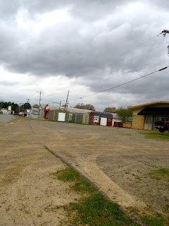
The old station is on the corner of Main and Beebe Capps, now overshadowed by the McDonald's and Burger King shooting angry glances at each other from opposite sides of the street. It has been a feed store in the past, and now a couple of old women are selling random stuff (that explains the fluorescent poster boards) out of it. I didn't know it was a station until the man who runs the museum at Bald Knob told me. Upon closer observation, the building has a telltale sign of a train building: a loading dock.
The tracks used to run right past that dock (and some still protrude from the earth farther down the road). As the train tracks disappeared, this part of Searcy slipped into obscurity; a 19th century wooden passenger car found itself marooned on a lonesome piece of track and eventually became a private residence. Later, the historical society rescued the car. It's the last of its kind and will be the subject of a later entry.
Train travel is all but dead. The Arkansas Encyclopedia tells me that at its height, Arkansas had around 4,000 miles of train tracks. It now has closer to 2,000. The man at Bald Knob told me the last time a passenger car passed through their station was in the 70s. The more I think about it, the more I'd love to just ride a train from Bald Knob to Little Rock. I know and understand the necessity of interstates and 70 MPH speed limits, but there is something undoubtedly romantic about trains, and our country has just about lost that romance. Sure, there's still Amtrak, and sure, trains are still in constant use across the pond (heck, I rode trains everywhere in Japan), but it's here that I miss them the most.
Here's to the trains.
Sunday, March 29, 2009
Thursday, March 26, 2009
Get your Petrol in Wonderland
"There's this incredibly creepy place I have to show you," my friend Drew told me one night as we were cruising around North Little Rock. "You have to drive through a swamp to get to it. But I have no idea what it is, so I won't be able to answer any questions."
He took us under the major freeway (67) and onto a road which used to be the main thoroughfare between St. Louis and Little Rock (now 167). The rows of brightly lit gas stations quickly dissolved, and Drew was correct--to our left and right, dismal swamps with cypress trees spidering out of the depths. The bleaching effect of the headlights heightened the spooky atmosphere. As we drove, I tried to picture what I might be about to witness. An abandoned gothic mansion, maybe? But that would be too explicable. Soon enough, we mounted a small hill and this bizarre, abandoned building stood in front of us:
(Note: this picture was taken at a later date, obviously during the day. Click to enlarge.)
"Like I said, don't ask me what it is," Drew repeated. We circled around the tiny building a couple of times, scratching our heads. "I went inside one time," Drew continued. "You wouldn't want to. I found all manner of illicit activity in there." As we looked on, I noticed this structure on one side of the building.
A weirdly-shaped light pole and a concrete island. While we came around to the other side and started driving back towards the highway, I mused. "Hmm. Drew, I think I know what that was," I said. When we returned to his house, I hit up one of my favorite resources, Roadside Architecture, and almost immediately found my answer under "gas stations."
That bizarre thing was once the Roundtop Filling Station. It was built in 1936 as a winner of an architecture contest and has been sitting there, vacant and unused, for 50 years. I knew what I was looking at because of the concrete island: I could see the marks where the gasoline pumps once stood. Finally, Drew's questions were answered.
Can you imagine getting your gasoline from a place like that? It's like a magical gnome house in the middle of nowhere. When they invent time machines, people are going to think I'm batty for wanting to visit a gas station. It's on the historical register, by the way.
Lastly, I should note that this ghost of a building was one of the main inspirations for me to explore more. What treasures might I find if I just looked a little harder? Plenty, it seems.
Tuesday, March 24, 2009
The Bald Knob Farmers' Market
Between 60 and 100 years ago, Bald Knob and Judsonia really had something going for them: strawberries. The little red guys were a major source of the towns' success, and every summer during the peak season folks from all over the place would gather at the Bald Knob Farmers' market. It took place at a group of long, covered buildings just near the train tracks, where the railroad cars would deliver crates and crates of the fruit. It was a time of community for the towns; they would all gather to help unload and prepare the strawberries for sale.
Here's the market in the 1940s. Click to see larger images. You can see crate of strawberries on the truck in the second picture. Note the old multi-tiered telephone poles in the background. These still stand all along highway 64 going towards Wynne, but many of them are skewed at strange angles, their long-unneeded telephone cables drooping to the ground.
Here's the strawberry craze going on in Judsonia in 1915. This is a part of Judsonia I still need to go and take pictures of (I have to check if that huge house is still there).
Here's a more recent (1960s) aerial photo of the farmers' market during an off season. Note the service station on the left side of the photo; that now is Bald Knob's fire station.
By the time the 60s and 70s rolled around, the strawberry market was in its death throes. Now we just go to Wal-Mart whenever we need strawberries, although I have heard that Arkansas strawberries still have a delicious reputation. But while the farmer's market has dwindled to nothing, the buildings still stand, reminding us of a time when the town came together like a family.
My lovely fiance and photography partner makes a cameo in the third photo. Anyway, as far as I can tell, all of the market buildings are intact, but don't seem to to see much use. At least one of them had a storefront built into the front of it. It currently houses nothing but dust and roaches.
This is the kind of thing I love to discover about these small towns. It's sweet like strawberries to unearth what history lies in some otherwise fairly boring and nondescript buildings, but then bitter to see where time has landed them. If I had a time machine...well, I don't, so let's leave it at that.
Saturday, March 21, 2009
Turn Left at the Dinosaur
A busy week meant I didn't post on Thursday. I was going to throw up a quick one (sounds kinda gross) that night before I went to bed, but it didn't happen then, so it will now.
A road that will be referenced many times from now on is the old highway: 367. It travels from Batesville to Cabot and probably further, but that's the extent of my mileage. Being an older highway, it's rife with exactly the kind of things I'm looking for. But this particular one isn't something old, ruined, or meaningless; it's just something weird.
Behold, the Allosaurus of 367! This metal monster has had a colorful history on the old highway. He used to be the mascot of a pretty large metalwork lawn art-type place further down the road. When I drove by him, I'd think, "If I had a lot of money to waste, I would totally buy that dinosaur." Apparently somebody beat me to the punch, because one day he appeared in front of this tiny car dealership (a former service station; many of the smaller dealerships are) in Judsonia.
It seems dino gained some personality since moving to Judsonia. At the time of this picture, he had picked up a cowboy hat and is being ridden by some kind of baby doll. Before this picture was taken, the baby doll was in his mouth. When I saw dino the other day, he had been a calm shade of green.
That's all for today. I expect to make a longer post tomorrow.
Tuesday, March 17, 2009
The Historical Register
I've decided to hold off on trains or theaters for a while because I still need to take a few more pictures first. For the sake of clarity!
So for now let's talk about the National Register of Historical Places. I'd heard about this particular group plenty of times in the past, usually in reference to some building or another. One day I found a link to their web site, and then the listing for White County. When I printed it out, I got something like 20 pages of data.
My immediate impulse was to travel all over Searcy and the neighboring towns to try to find items on the list. The site listed what the buildings were previously used for and what they're used for now. Some of them were listed "vacant/not in use." Most of the entries were made in the early 90s, though, so we were prepared for failure. We did unearth quite a few gems, however. Here are some obvious ones, first.
Trinity Episcopal Church; the Methodist Church; the Rialto Theater; Cumberland Presbyterian Church; the Confederate war memorial outside of the courthouse, respectively. All of these are on the register, and all of them have some sort of historical value. For examples, those are definitely the three most old and beautiful churches in Searcy (although there is one that's even older, but that's for another time).
Here are some buildings which may be a little less obvious:
1. Bank of Searcy, now an office space. I don't have an old picture of this building, but there is a tiny plaque on the side which reads "bank of Searcy, 1908." Imagine a time when a town would only have one bank, and everyone knew the people who worked there.
2. Former Searcy Post Office. It's some kind of court building now. I love the architecture on this building; if you've ever been to any of the current post offices in Searcy, you'd probably agree with me. The right picture is circa 1955. Note the addition on the rear of the current view.
3. Robertson's drug store, now Quattlebaum's music center. Note that the building just next door, Stott's, is a drug store and seems to have been operating at the same time as Robertson's. Also note that at some point it seems to have been a cafe. In the contemporary photo, there is a tiny black rectangle on the corner of Robertson's just under the awning. That's a plaque which reads "Robertson's Drug Store, 1860."
4. Mayfair Hotel. This is one that jumped out at me: I've always seen this building (home to apartments and a couple of businesses now) and thought it belonged somewhere in Europe. Evidently it used to be a center for community in its day, serving both as a hotel and a restaurant. Behind the building is a large parking lot, which in previous times was a garden for the hotel's owners. Here's a picture of that:
Paved paradise, put up a parking lot. Classic case.
Some photos courtesy of the White County Historical Society (http://www.argenweb.net/white/#). For those curious, here's the National Register for Historical Places: http://www.nps.gov/nr/ .
Sunday, March 15, 2009
Judsonia and the Terrible Twilight
If one strolls through the Judsonia cemetery on Van Buren street, one might notice a considerable number of graves dating from March of 1952. W. E. Orr, author of That's Judsonia, has something to say about that.
"'We've got to get out of here,' Ernie shouted to Bernice. It was strange that they could hear each other even though they seemed to be buried in noise. Abraham pulled the door open. Roth grasped the back of Ernie's coat in both hands. To their horror they saw Waller's store, directly across the street, crumble into a pile of broken bricks and concrete. A sign, fully five feet long, came hurtling up the street and struck Abraham in the chest. Then, like an animated object in a movie cartoon, it instantly changed its course and sailed out of sight over the top of the two-story Farmers and Merchants Bank. Bernice, yelling above the storm, asked Ernie if he had been hurt. Ernie screamed back that he didn't think so. They grabbed a power line pole, only to have it sucked from their grasp and vanish. Then, Ernie saw the hydrant. They fell toward it grasping it with all their strength. As they hugged their stubby haven what was left of the Holmes building fell over them. Ernie heard Roth say that he thought his back was broken."
...
"Afterward they were to remember the silence--that and the eerie, yellow twilight. All over the stricken town people felt the clutch of that silence, almost as fearsome as had been the roaring a few minutes before. There was not a bird's call; not a human voice, not the sound of a single automobile."
...
"The next day Lin Wright used the following lead paragraph for his Arkansas Gazette story:
"'One thing can be said with certainty about last night in this area--it was hell.'"
Everyone who goes to Harding knows that we live in a particularly tornado-prone area, but perhaps we don't realize how close we are to doom sometimes. This particular 12th of March was host of at least two, possibly three tornadoes simultaneously, all of them attacking Judsonia. The little gang of tornadoes also took a nice bite out of nearby Bald Knob (a town which will be subject to several future entries...).
Orr's book was published in 1957, but I don't think Judsonia ever really recovered from their eerie twilight. Eventually the little town was bypassed by the two-lane highway 367 and then that bypass was bypassed by four-lane 67. Now most people probably don't know the town exists.
Here are some pictures of Judsonia, then and now:
Judsonia in 1908.
Judsonia during a rather severe-looking flood in 1927.
The same street, facing the opposite direction, in 2009.
Incidentally, W.E. Orr, the man who wrote the above account of the 1952 storm (and who devoted a whole chapter of the book to said storm; what is seen above is just an excerpt) is now dead and is buried in the same cemetery on Van Buren street. While visiting Judsonia, we ran across his grave.
I'm not sure what I'll talk about next, but it might be trains or theaters.
Also, I think I'm going to try for an update schedule of Tuesdays and Thursdays and perhaps Sundays.
Finally, for those interested, the pictures of the White County Courthouse featured in the previous entry were taken in the 1940s, 1957 and 2009 respectively.
Thursday, March 12, 2009
Some things never change
One of my favorite professors recently told me what it was like when he came to Harding in the late 60s. Back then, there was still a separate Church of Christ for black folks on Pleasure street, train tracks bisected Park and Harding Academy, and Beebe Capps was miles of dirt. "I've reached the end of the world," that professor thought.
Plenty of folks still consider Searcy to be the end of the world, and from their perspective, they're probably correct. But their world is different from mine; mine doesn't end where the strip malls and Starbucks and Megaplexes do. My worlds are numerous: White County is one world. Searcy is one world. Harding is a world. The region between rooms 210 and 212 in Armstrong, that's one world.
But the worlds I'm really looking for existed 30, 40, 100, 200 years ago. These are worlds that have eroded away into the stream of time. We can see them in the rails sticking out of the pavement at the place where Park is about to cross Main. We can see them in the photos of Elvis Presley dancing on the counter of the train station at Bald Knob. We can see them in the abandoned service stations all along highway 367.
So, travelers, I bring you greetings from the endless red river of time.